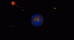
Visualization 2: Geographic Display
Displays physical location of remote servers
Status indicated by altitude, color of ball
Color of tether indicates server type